| |
|
|
| |
HOME AU-NZ |
|
KWH |
|
| |
Alice Springs & Uluru • Australia • March 2016 |
 |
| |
Click on images or links below to view an interactive panorama. |
|
| |
To the west of Alice Springs is the Larapinta Trail—a world-class, long distance bush walking trail that runs 223 kilometres (139 mi) along the backbone of the range. Along the trail is Simpsons Gap, Standley Chasm, Ellery Creek Big Hole, Serpentine Gorge, Ochre Pits, Ormiston Pound, Redbank Gorge, Glen Helen Gorge, Tnorala Gosse Bluff, Palm Valley,Mount Sonder, Mount Zeil and Mount Giles. (from Wikipedia)
|
|
| |
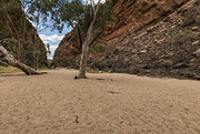
Standley Chasm Hike
March 5, 2016 |
|
| |
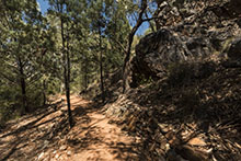
Standley Chasm View 1
iPad Version |
Standley Chasm View 2
iPad Version |
Standley Chasm View 3
iPad Version |
|
| |
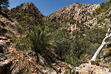
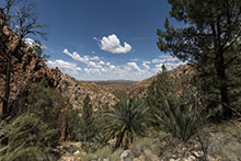
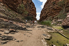
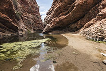
Simpsons Gap Hike
March 5, 2016 |
|
| |
Simpsons Gap Hike View 1
iPad Version |
Simpsons Gap Hike View 2
iPad Version |
Simpsons Gap Hike View 3
iPad Version
|
|
| |
Simpsons Gap Hike View 4
iPad Version |
MacDonnell Ranges on Wikipedia
Standley Chasm
Laparinta Trail |
|
|
| |
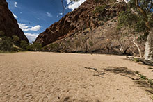
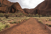
Uluru and Kata Tjuta
March 6, 2016 |
|
| |
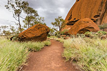
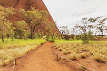
Uluru, also known as Ayers Rock, is a large sandstone rock formation in the Uluru - Kata Tjuta National Park, and is sacred to the Aboriginal people of the area. There are many springs, waterholes, rock caves and ancient paintings and Uluru is listed as a World Heritage Site for both its natural and man-made attributes.
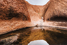
Kata Tjuta, also called Mount Olga or The Olga's owing to its peculiar formation, is another rock formation 25 km (16 miles) from Uluru. The name Kata Tjuta means "many heads" as it consists of 36 massive round rock domes covering 15 square miles. Higher than Uluru, the rock was once one giant dome that eroded to its present form. Both Uluru and Kata Tjuta have great cultural significance for the traditional landowners, the Anangu tribe. |
|
| |
Uluru Walk View 1
iPad Version |
Uluru Walk View 2
iPad Version |
Kata Tjuta View 1
iPad Version |
|
| |
Kata Tjuta View 2
iPad Version |
Uluru on Wikipedia
Kata Tjuta on Wikipedia |
|
|
| |
|
| |
Top |
Email K. Wayne Heil |
|
|